Hurricane Simon raked Mexico's Pacific coast with 120 mph winds as its eye tracked toward the Puerto Vallarta area late Sunday.
The big picture: Simon weakened to Category 3 strength Sunday but remained a dangerous hurricane just off Mexico's west-central coast. Its strongest wind and rain were expected around Puerto Vallarta near midnight and into Monday morning.
- The storm's eye was moving northwest about 45 miles south of Cabo Corrientes at roughly 5 mph. National Hurricane Center specialist Philippe Papin said that tip of mainland Mexico faced the highest chance of a direct hit.
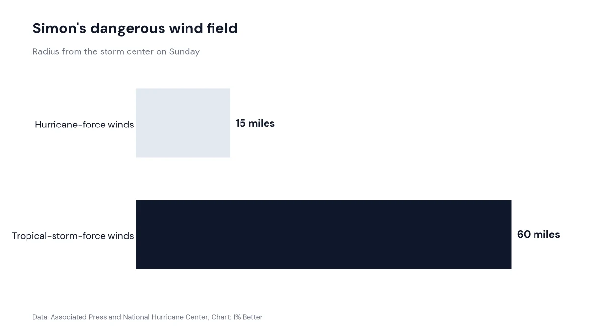
By the numbers: Hurricane-force winds extended 15 miles from the center, while tropical-storm-force winds reached 60 miles. Forecasters expected another 2 to 4 inches of rain across four states, with isolated totals as high as 30 inches.
- "We're expecting catastrophic wind and life-threatening storm surge impacts," Papin said, adding that heavy rain could produce dangerous flooding and mudslides in higher terrain.
What they're saying: Mexico's president urged residents to stay sheltered. Police used megaphones to clear people who were jogging, walking dogs and biking near Puerto Vallarta's waterfront while National Guard vehicles patrolled the streets.
Why it matters: The danger extends from coastal resorts to hillside communities with less storm-resistant housing. Travelers should remain sheltered, follow local evacuation orders and avoid flooded roads and the waterfront until authorities lift restrictions.