A Kelvin wave, a deep ocean wave stretching thousands of miles, is raising sea levels along the US West Coast as this year's El Nino builds.
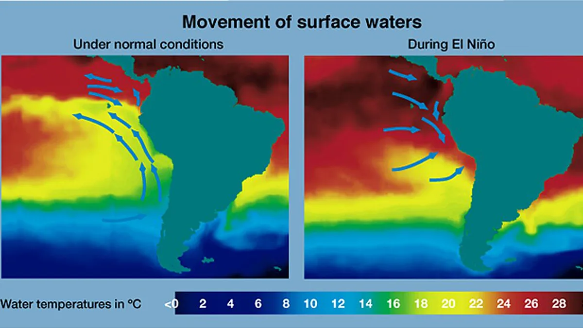
Zoom in: Kelvin waves form along the equator in El Nino years, when a vast region of the Pacific runs much warmer than usual. The warm water travels slowly east beneath the surface to South America, then splits and runs north along the West Coast and as far south as Chile.
- "It's a planetary-scale wave," says Dillon Amaya, an assistant professor of atmospheric sciences at North Carolina State University, who separates it from the visible surf that crashes ashore in storms.
By the numbers: Sea levels off Southern California were already six to eight inches above normal from the Kelvin wave in early October. Then Tropical Storm Rachel hit, and the storm surge flooded neighborhoods and left oceanfront homes partly submerged.
- "That storm surge was almost certainly made more devastating because of the Kelvin wave," Amaya says.
Between the lines: A Kelvin wave raises the water and loads the dice. Amaya says flooding needs a trigger on top of it, such as a major storm or very high tides. Josh Willis, a climate scientist at NASA's Jet Propulsion Laboratory, calls the risk a triple whammy of El Nino, high tide and storm surge arriving at once.
The backstory: Lord Kelvin, the British physicist behind the temperature scale, first described the wave in the late 1800s. "It does surprise me, I mean, here it's been around all this time," says Mark Cane, who built one of the first El Nino forecast models. "I'm sure Lord Kelvin is happy in his grave."
The big picture: Warm water rides along with it, stressing marine life. A whale shark was spotted off San Diego, tropical fish are turning up out of range, and researchers have already seen sea birds dying as the warm layer pushes down the cold, nutrient-rich water that feeds the ecosystem.
What's next: Amaya expects the next wave to reach San Diego in late October or early November, with several more through fall and early winter. A strong El Nino year usually brings five or six. NOAA researchers expect this El Nino to stay strong into early 2027.
Why it matters: Anyone on the California coast now lives with a raised baseline for months, so an ordinary king tide or winter storm arrives on top of an extra half foot of water. That margin is the difference between a wet street and a flooded living room.